Movement strategy
In response to the priorities opposite, and working collaboratively with Essex County Council, a series of surveys and studies were undertaken to help shape the movement strategy.
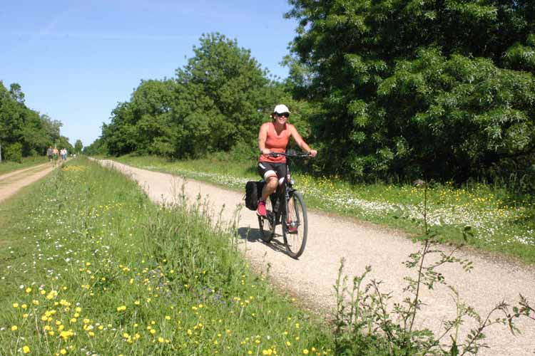
The aim is to create genuine choice for the existing and future communities to access the new homes, facilities and open spaces without having to drive, by creating direct walking, wheeling and cycling routes.
The Neighbourhood Centre, open space, play areas and the new primary school have been positioned so that existing residents can reach these via direct and safe pedestrian and cycle routes. The movement strategy aims to incorporate and alleviate a number of concerns regarding the impact the development will have on existing traffic levels and explains the approach to promoting walking, cycling and public transport.
The proposals will deliver:
- over 7 km of connected walking routes through opens space and parkland
- the new Neighbourhood Park and centre lie within a 10 minute walk from the junction of St John’s Road and Little Clacton Road
- new walking and cycling routes connect into existing PRoW and the wider countryside
| Community priorities for Clacton | How our proposals have responded | |
| Movement |
traffic in the local area | proposals are designed to encourage walking, cycling and wheeling. These include new footpaths and cycle routes with direct routes to the wider Clacton area, delivering around 7km of new paths through parklands |
| traffic specifically on Little Clacton Road |
the movement strategy will encourage traffic onto the new Main Street and reduce traffic on Little Clacton Road, making it safer. | |
| parking | parking will be provided for all homes in line with standards | |
Movement strategy - click to enlarge
Wider movement context
Click to enlarge
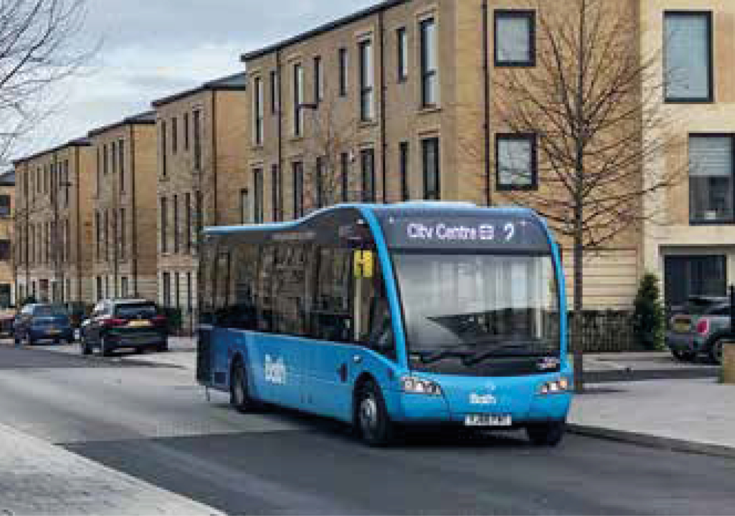
Road network designed to carry buses down the Main Street, through the employment area and the northern neighbourhood
A connected network of parks and greenways providing safe routes for everyone including children wheeling to school
Access
Vehicles
It is recognised that there is a need for people to drive and that the new development will still generate car trips. Collaboration with Essex County Council is focused on identifying the most effective access solution for the application site while responding to your concerns raised.
Four access points are being proposed in the planning application in accordance with the SPD, as detailed 1 to 4 on the Movement Strategy.
A bus service is proposed to run north to south through Hartley Gardens.
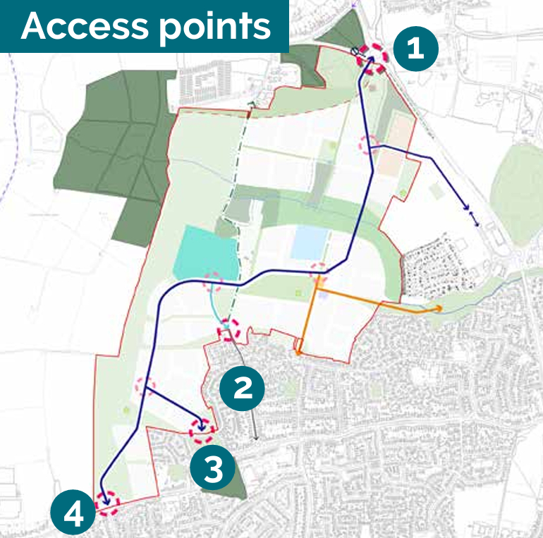
Access points - click to enlarge
The access strategy set out in the SPD identifies these access points:
- A133/ Progress Way/ St Osyth Road
- Little Clacton Road (potential off site improvement)
- Legerton Drive
- St John’s Road
1. A133/ Progress Way/ St Osyth Road
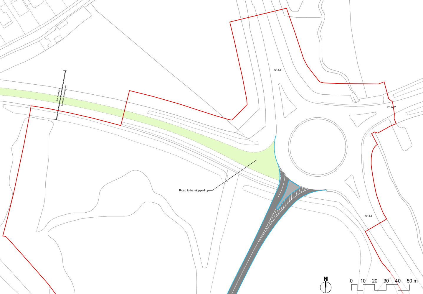
In the north, the existing roundabout for the A133 / Progress Way / St Osyth Road will be changed to provide a new connection into the application site. The existing arm into St Osyth Road would be closed to down-grade the Little Clacton Road and address the safety concern (reducing traffic on Little Clacton Rd). Public transport and homes along St Osyth Rd and St Osyth Rd West will be accessed through the new development, and details of new access arrangements will be confirmed through future engagement with residents at detailed design stage.
The existing route has the potential to be re-designed to serve walking and cycling, creating a safer envrionment along St Osyth Road.
2. Little Clacton Road (potential off site improvement)
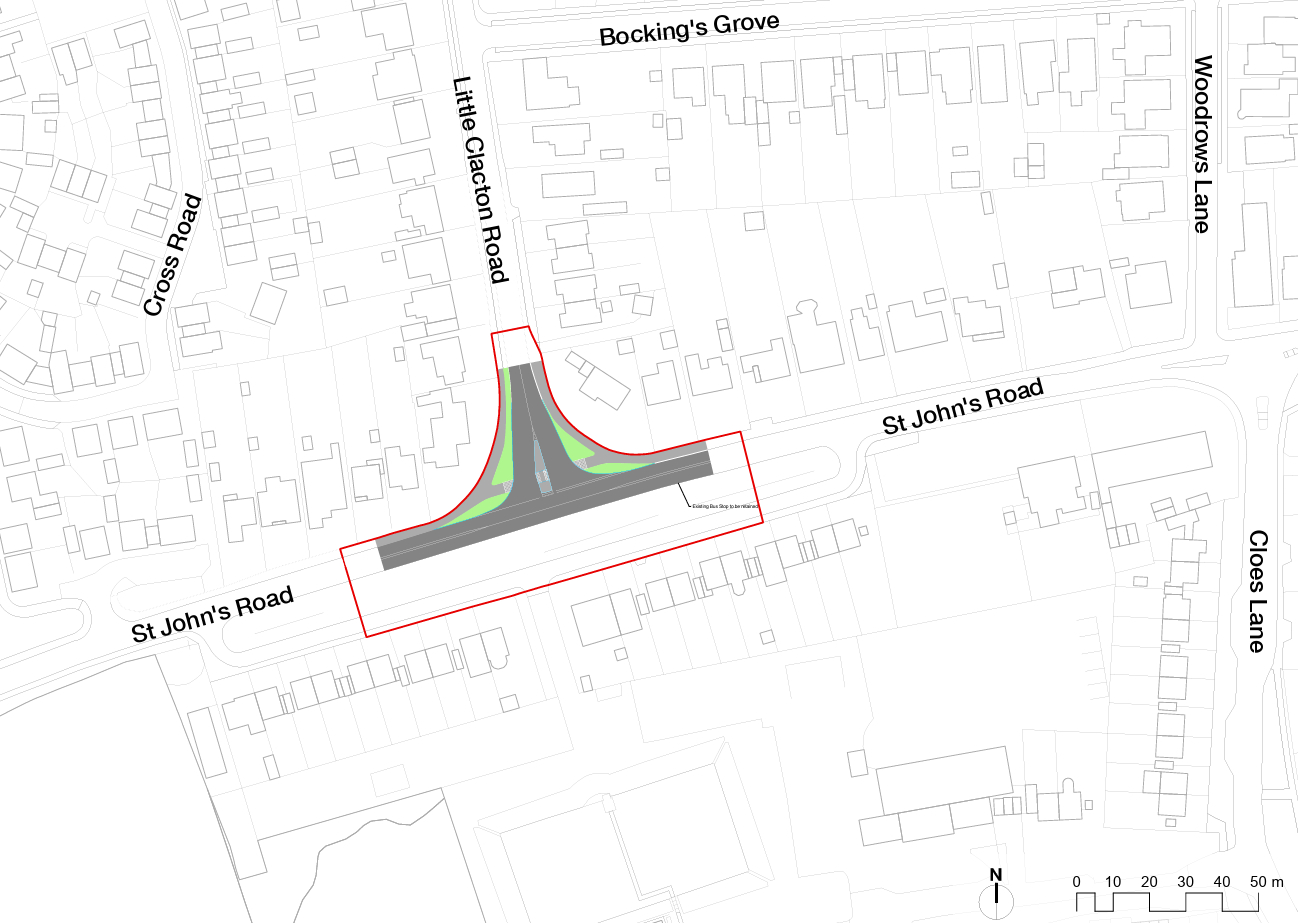
On the southern end of Little Clacton Road changes will need to be made to the junction to improve the flow of traffic, consistent with current Manual for Streets and/or Essex Highway Design requirements. The currently designed improvement, if delivered, would lead to the loss of the existing tree on the junction of Little Clacton Road and St John's Road. This will make the junction perform better than other options considered.
3. Legerton Drive
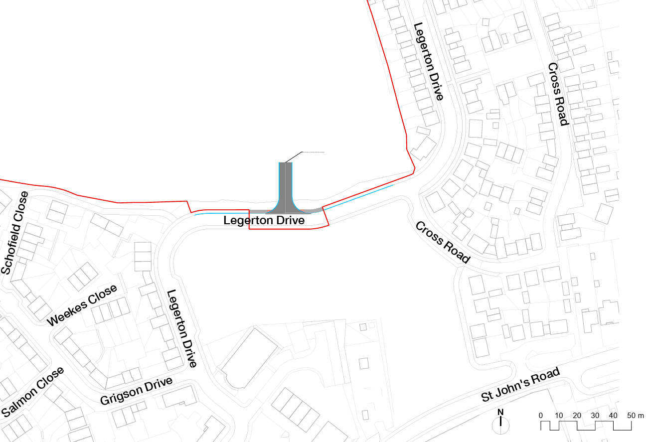
Legerton Drive forms part of the road network which currently serves an existing area of residential development to the north of St John’s Road and a new access is proposed on its boundary with the Site, leading directly into the Site. This is intended to be delivered as part of the early stages of the development, and ultimately will be a secondary access point.
4. St John’s Road
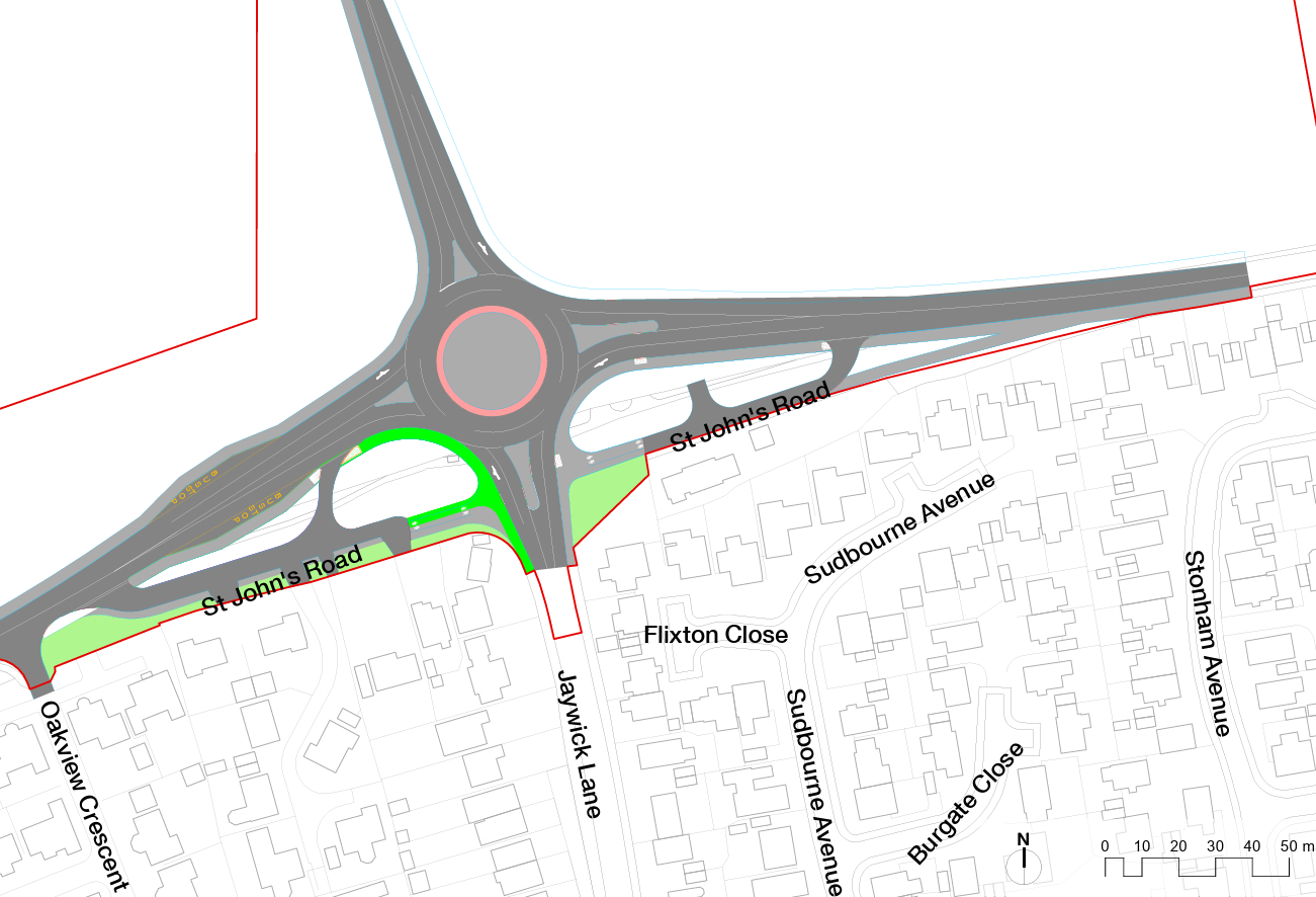
To enable more efficient bus services through the site and along St John’s Road, the junction preferred by the Highways Authority (Essex County Council) is an enlarged roundabout at the junction of St John’s Road and Jaywick Lane. This new roundabout would also provide access into the site and continued access to all existing properties. Access to the adjoining residents will be provided at all times. An advantage for these residents will be that traffic will move further from their property boundary.